
Google Earth
- Thread starter QUALTHWAR
- Start date
-
Two Factor Authentication is now available on BeyondUnreal Forums. To configure it, visit your Profile and look for the "Two Step Verification" option on the left side. We can send codes via email (may be slower) or you can set up any TOTP Authenticator app on your phone (Authy, Google Authenticator, etc) to deliver codes. It is highly recommended that you configure this to keep your account safe.
You are using an out of date browser. It may not display this or other websites correctly.
You should upgrade or use an alternative browser.
You should upgrade or use an alternative browser.
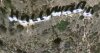
Found it!  Used the keywords "Mt. Lee" since "Hollywood sign" would just be too cheap. It's the mountain where the sign sits over.
Used the keywords "Mt. Lee" since "Hollywood sign" would just be too cheap. It's the mountain where the sign sits over. ive found more runway in area 51
in the lighter patch that says its groom lake there is some "road" that lincs to nothing, so i figered it must be more runway. so area 51 has a resounding total of 11.12 miles of runnway. thats including the very long one at 4 1/2 miles, but not the one wich is actuly a path for the grounded "air craft" can get to the hanger. it looks like it joins with the road but it doesn't it stops about 100 foot short.
in the lighter patch that says its groom lake there is some "road" that lincs to nothing, so i figered it must be more runway. so area 51 has a resounding total of 11.12 miles of runnway. thats including the very long one at 4 1/2 miles, but not the one wich is actuly a path for the grounded "air craft" can get to the hanger. it looks like it joins with the road but it doesn't it stops about 100 foot short.
The way I find stuff is use the google advanced search. I'll type something like “Hollywood sign” in the exact phrase section, and “longitude” in the “all the words” section. I figure if they talk about longitude, they’ll probably also talk about latitude.GTD-Carthage said:Found it!
Sometimes sites will give conflicting coordinates, some will use decimal form that needs to be converted, and some will give a general coordinate, but not specific enough to pinpoint something.
I had a difficult time finding the Hollywood sign this way. I knew there was a radio tower nearby, and people would talk about seeing the sign from various places, but you can see the thing from all over the area.
The Leaning Tower of Pisa was another one that was really hard to find, and I accidentally ran across a site that had a Google Earth link to the coordinates. All the other coordinates that I found was off by enough where I couldn’t find it.
Finding sites can be a real challenge. I found the Whitehouse after remembering they made a movie called “Murder at 1600 Pennsylvania Avenue.” I followed Pennsylvania Ave until I found it. I found the Palm Island of Dubai by examining how the road diverged away from the coastline. Niagara Falls was also difficult to find using my methods. It’s the thrill of the hunt. Lol.
There are multiple runways at area 51, that’s for sure.madmoo said:ive found more runway in area 51
in the lighter patch that says its groom lake there is some "road" that lincs to nothing, so i figered it must be more runway. so area 51 has a resounding total of 11.12 miles of runnway. thats including the very long one at 4 1/2 miles, but not the one wich is actuly a path for the grounded "air craft" can get to the hanger. it looks like it joins with the road but it doesn't it stops about 100 foot short.
but that is a lot of runway.
i was zoomed in realy far but still not to close and i found a glich somwear in the czec republic. it was a busiling city and then it was a field so some images are older than others.
i started looking for these and in about 40 or 50 of the 125 citys i looked at did this it was realy strang to see a realy high res next to a realy low res. it looks higher than the high res.
I’m not sure what you mean by a field next to a city, but I’ve seen plenty of places where the low res ends and the high res starts. Not sure why they stop in certain places. I can see why they scan some places at high res for now, and leave others at low res. This is one example. This is Victoria Falls. There’s probably nothing really interesting around the falls, so they just did a high res at the falls.
Attachments
Cat Fuzz
Qualthwar's Minion. Ph34r!
some parts of google maps are over 4 years old.
i googled my dads house and the blue car i drove when i was in H.S. was still parked in the driveway (sold when i graduated in 2001)
but then i googled the place i lived at in bremerton WA. and found my freinds car there (bought 1 month after i moved in 2001)
so it seems a lot of areas are kinda 'hit and miss'
My hometown doesn't have high-res images. Google Maps only gives off up to the fifth closest zoom there...
Google Maps only gives off up to the fifth closest zoom there...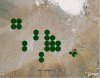
QUALTHWAR said:like this...
That's just the 3d model of the building sticking up. Tilt the camera to see...
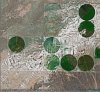
more beta pics
most of these pics are labled and here is the key:
red line= path or road (my be edges of field or a boundry)
yellow dot= sorce of light to form the shadows
pinc ciercle around= around a camp site or transmition viacles
the rest speaks 4 its self
the dots seem to be filterd on so i think they are put there by the admins or authorised members of area 51 or fbi or even the AMCA (american, military, censorship, asosiation)
but the yercusk version is beta YMCA
Attachments

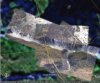
Left of Area 51 is this strange landscape, kinda assuming it's some sort of bombing range / test area but the strange thing is there appear to be buildings and roads purposely built around those crater / mound like structures - weird
http://maps.google.com/maps?f=q&hl=en&q=area+51&t=h&ll=37.122959,-116.048069&spn=0.058855,0.170288
http://maps.google.com/maps?f=q&hl=en&q=area+51&t=h&ll=37.122959,-116.048069&spn=0.058855,0.170288
Last edited by a moderator:
ther probly were they dup mine type things and did there nuclyer testing underground. the roads are there so its easyer to study the crators. the buildings are probly reserch bunkers or to study the efects of nuclyer activity on buildings or sumit like that
There could be loads of reasons. Prefabs used for testing munitions. Was a range, but isn't anymore. Etc.