Google Earth

  • Two Factor Authentication is now available on BeyondUnreal Forums. To configure it, visit your Profile and look for the "Two Step Verification" option on the left side. We can send codes via email (may be slower) or you can set up any TOTP Authenticator app on your phone (Authy, Google Authenticator, etc) to deliver codes. It is highly recommended that you configure this to keep your account safe.

QUALTHWAR

Baitshop opening soon.
Apr 9, 2000
6,432
71
48
Nali City, Florida
web.tampabay.rr.com
I know this is old news, but i got it yesterday and have been checking it out. I was hoping to see the Nazca lines, but i can't see any details of animals or anything. I can see straight lines, though.

Also, checked out area 51. Pretty cool. I'm still wondering why there are weird smears coming off objects at area 51. Don't see it anywhere else.
 
Last edited:

GoAt

Never wrong
Nov 3, 2001
1,444
10
38
42
USA
Visit site
im curious to know why a 2 mile run way is needed.

NAS Pensacola only had a 1mi run way and they landed C-130s, fighter craft, and other heavy air crafts all the time.
 

Reign

The only candy with the Petey crunch
Aug 3, 2002
303
0
0
52
Digital Bliss
Visit site
I've seen everywhere man, I've seen everywhere.

So you've discovered the power of Google Earth too. It is a pretty cool utility to have at your command, especially for free. :tup:

Have you tried plotting courses from one place to another? The only problems that I've seen with GE are the out dated images, the lack of detailed images in some remote areas (as mentioned earlier) and the misplaced markers for the locations of some businesses. There's a KFC in my area that they have located in the middle of the avenue in the path of on coming traffic. (I know KFC has drive-thru service but come on!) :lol:
 

QUALTHWAR

Baitshop opening soon.
Apr 9, 2000
6,432
71
48
Nali City, Florida
web.tampabay.rr.com
GoAt said:
im curious to know why a 2 mile run way is needed.

NAS Pensacola only had a 1mi run way and they landed C-130s, fighter craft, and other heavy air crafts all the time.
I’ve been doing a little research out of curiosity, and a 2-mile runway is nothing. Tampa International airport has a 2-mile runway. Another smaller airport nearby has a 1.7 mile runway.

Google Earth allows you to measure distances, so I looked at the longest runway at Area 51 and if you had to use the entire thing, it measures 4.5 miles long. It longs like half of that is good runway, and the other half is older runway, but still, if you needed that much you have it. That’s almost 24,000 feet of landing strip.
 

QUALTHWAR

Baitshop opening soon.
Apr 9, 2000
6,432
71
48
Nali City, Florida
web.tampabay.rr.com
Reign said:
So you've discovered the power of Google Earth too. It is a pretty cool utility to have at your command, especially for free. :tup:

Have you tried plotting courses from one place to another? The only problems that I've seen with GE are the out dated images, the lack of detailed images in some remote areas (as mentioned earlier) and the misplaced markers for the locations of some businesses. There's a KFC in my area that they have located in the middle of the avenue in the path of on coming traffic. (I know KFC has drive-thru service but come on!) :lol:
I’m having the same aftereffects with GE as I did with UT Editor. I want to zoom in and out with my scroll button all the time.

Yeah, I plotted a course from my place to a friend’s house and found out he’s about 18 miles away. No wonder it takes me so long to get there.

I don’t know if I’ve seen any markers misplaced. They might not place a marker right on top of a builder in case the building is small, so I can understand markers placed in a road adjacent to a building.

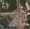
I’ve checked out some cool places such as the Roman Coliseum, St. Louis Arch, Panama Canal, Mount Everest, The Alps, Eiffel Tower, race tracks and ball fields, Great Wall of China, North Pole, Easter Island (poor res.) Nazca lines, Stonehenge (poor res.) Mount Rushmore, Leaning Tower of Pisa (can’t really see it – might be missing location a bit) Death Valley, Space Shuttle at Cape Canaveral, and possible impact craters.

I’ve also located places where I’ve lived and worked. In fact, I’m sort of using it to records how I’ve progressed through jobs and through housing. Next, I plan on painting a big smiley face on top of my building in the hopes I'll see it if they ever update this goofy program.
 

QUALTHWAR

Baitshop opening soon.
Apr 9, 2000
6,432
71
48
Nali City, Florida
web.tampabay.rr.com
Mmmm, that’s weird. The longest landing strip measured out to 1.5 miles. It looked like the one they use to land on, too. I'll have to wait to check it again. For some reason the program closed out on its own and I lost a bunch of places I had saved. I had the program open for like 3 days. Maybe it ran out of memory.
 

QUALTHWAR

Baitshop opening soon.
Apr 9, 2000
6,432
71
48
Nali City, Florida
web.tampabay.rr.com
MassChAoS said:
The landing strip for the shuttle is 2.84 miles (15000 feet)

http://www-pao.ksc.nasa.gov/kscpao/nasafact/landingfac.htm

On a side note, the shuttle would only typically land in Florida, New Mexico, or Cali.
I’m not sure what’s going on, but this seems to be the longest runway at KSC. It measures out less than 2 miles. That doesn’t make sense either since airport runways are longer. Also, the runway I posted is #36 and I read they land on runway #33. #33 is supposed to be 15000 feet.
 

Attachments

  • landing.jpg
    landing.jpg
    109.8 KB · Views: 17

GoAt

Never wrong
Nov 3, 2001
1,444
10
38
42
USA
Visit site
QUALTHWAR said:
I’ve been doing a little research out of curiosity, and a 2-mile runway is nothing. Tampa International airport has a 2-mile runway. Another smaller airport nearby has a 1.7 mile runway.


i guess google has their measuring stick wrong. since TPA's runway seems to be about 200 feet shorter than Area 51s.
 

MassChAoS

echo "NaliCity";
May 23, 2002
1,176
0
0
www.chaoticdreams.org
QUALTHWAR said:
I’m not sure what’s going on, but this seems to be the longest runway at KSC. It measures out less than 2 miles. That doesn’t make sense either since airport runways are longer. Also, the runway I posted is #36 and I read they land on runway #33. #33 is supposed to be 15000 feet.

That pic is an airforce runway... this is the landing strip for the shuttle:
http://maps.google.com/maps?f=q&hl=...28.616323,-80.681877&spn=0.049352,0.10849&t=h

Its north-northwest of the one in the pic.